


*River conditions described below may change at any time. For the latest, check rivers.alberta.ca.
—
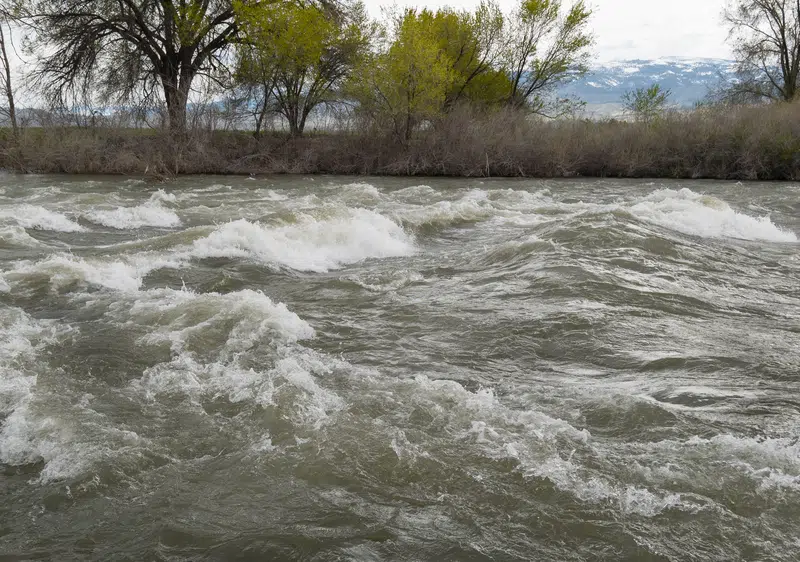
After this week’s rainfall, parts of the North Saskatchewan River Basin are under close monitoring with potential for flooding.
The Clearwater River near Rocky Mountain House, which the province said Thursday night was under a flood warning, is now under a flood watch, but according to rivers.alberta.ca, as of 1 p.m. June 17, the water levels are going down.
Other parts are under a high streamflow advisory. More here.
The low pressure system that brought rain to much of Alberta this week moved into Saskatchewan June 15. This system brought nearly 75 mm to Rocky Mountain House between noon Sunday and noon Wednesday, according to Environment and Climate Change Canada.
The North Saskatchewan River (NSR) seems to have peaked, while there remains concerns for the Clearwater River.
Laura Button, Communications Coordinator for The Town of Rocky Mountain House, said, “The NSR has been under a high streamflow advisory all week. We reviewed the flood response section of our Municipal Emergency Management Plan on Monday morning in case things escalated. Rivers.alberta.ca shows the river is trending back down from its Wednesday night high flow.”
Button added, “It was a long week for the Water Treatment Plant operators and the sewer system was challenged with two to three times the normal water volume, but things have stabilized now.”
According to Rivers Alberta, high streamflow advisories are also in effect for Brazeau River, Ram River, Prairie River, Baptiste River and the Nordegg River.
Flood peaks in the major rivers are expected to move across the province over the remainder of the week. Flood mitigation infrastructure continues to hold and there has been no major flooding. Albertans can monitor the flood peaks using near real-time water levels and river flows on rivers.alberta.ca and the Alberta Rivers App.
Visitors in affected campgrounds are being notified of severe weather and high water levels and should be prepared to evacuate on short notice. All campgrounds are now open.
The rainfall has caused park closures throughout the area. According to Environment and Parks Alberta, visitors in affected campgrounds are being notified of severe weather and high water levels and should be prepared to evacuate on short notice.
Current park closures include:
• Crescent Falls provincial recreation area
• Seven Mile provincial recreation area
• Prairie Creek provincial recreation area
• Tay River provincial recreation area
• Medicine Lake provincial recreation area
• Red Lodge Provincial Park
• Strachan provincial recreation area
• McKinnon Flats day-use area
• Access roads to Dry Island Buffalo Jump Provincial Park
According to Christine Heggart, Director of Emergency Management, Clearwater County, due to some localized flooding, Clearwater County activated its Incident Command Post (ICP) to staff appropriately to deal with public safety, road closures and signage, public communications and should any evacuations have been required.
Heggart says several County roads were impacted by overland water or rivers and to various degrees. The James River Road sustained the most significant damages (as reported to date).
Road repairs and maintenance are already underway across the County roads. Reopening updates will be provided on Facebook and the County website, as repairs are completed.
The ICP remained active until 4:30 P.M. on June 16, when www.rivers.ab.ca indicated that peak flows had been reached and water levels appeared to be receding in most rivers/tributaries.
There were no County evacuations and no state of local emergency (SOLE) declared. Clearwater County is aware, however, that a few private campgrounds and properties received flood waters or overland water.
The Government of Alberta continues to work directly with affected municipalities through the Alberta Emergency Management Agency.
More information is at albertaparks.ca.


Comments